Civil CAD Drafting Services

Do you need expert support for your civil engineering projects? We specialize in land development design, site grading, surveying, topographic mapping, 3D modeling, site layouts, infrastructure drafting, boundary surveys, ALTA/NSPS land title surveys, and geospatial analysis. Let us help transform your concepts into accurate and efficient engineering solutions.

Civil CAD Drafting Outsourcing Company
Civil CAD Drafting Services
Trusted by the Best

Clients we
work for

Edit Template

Civil Engineering Design & Drafting Experts

We are a leading India-based outsourcing partner delivering high-quality civil CAD drafting and design solutions for the global civil engineering industry. With over 20 years of experience, we specialize in providing accurate, scalable, and cost-effective engineering support for land development, urban planning, infrastructure, transportation, renewable energy, environmental engineering, and survey projects.

Land Development & Site Engineering
  • Comprehensive site development planning and engineering design
  • Site grading and earthwork modeling using Civil 3D
  • Surface modeling, contour generation, and corridor design
  • Site layout planning compliant with local/international development standards
  • Utility coordination and infrastructure planning
  • Residential, commercial, and mixed-use land development support
Grading & Earthwork Analysis
  • Existing and proposed surface analysis
  • Cut-fill quantity calculations and optimization
  • Slope analysis and grading plan development
  • Earthwork balancing for cost-effective construction execution
  • Terrain modeling and surface optimization
Renewable Energy Design
  • Solar farm site layout development
  • Access road alignment and grading
  • String plan preparation for renewable energy projects
  • Site feasibility and constructability analysis
Survey & Topographic Engineering
  • Boundary survey drafting and documentation
  • Topographic mapping from survey datasets
  • Processing and modeling using Trimble point cloud data
  • Preparation of survey forms, finals, and field documentation
  • Conversion of raw survey data into engineering-ready CAD models
Geospatial & GIS Analysis
  • Property geolocation and elevation analysis using QGIS
  • Spatial data interpretation and mapping
  • GIS-based planning support for government and infrastructure projects
  • Terrain and geographic data visualization
Structural Coordination & Analysis
  • Basic structural load analysis using FortWeb
  • Structural support coordination for civil infrastructure
  • Evaluation of site-based structural requirements
  • Development of optimized engineering solutions based on site conditions
Government & Property Valuation Projects
  • Experience supporting government property valuation initiatives
  • Coordination within multidisciplinary engineering teams
  • Property planning, mapping, and technical documentation
  • Data analysis and drafting support for valuation workflows
Drafting & Technical Documentation
  • Detailed engineering drawings and construction documentation
  • CAD drafting for land development and infrastructure projects
  • Preparation of topographic plans, grading plans, and site layouts
  • As-built drawings and revision management
  • Client-standard drafting compliance
Collaboration & Project Delivery
  • Cross-functional coordination with engineers, surveyors, and clients
  • Delivering high-quality, code-compliant engineering solutions
  • Strong understanding of local/national land development standards and workflows
  • Efficient project execution within deadlines and quality standards

Browse Our Expertise in Civil Drafting Services

ALTA/NSPS Land Title Surveys
As-Built Survey
Aerial/Drone Survey
Boundary and Location Survey
Topographic Survey
Metes & Bounds
Mortgage Survey
Foundation Survey
Subdivision Platting
Right of Way and Route Survey
Record of Survey (ROS)
Utility Survey (Gas, water, fire, power, etc)
Plot Plan
Final Survey
Demolition and Remodeling Survey
Control Survey
Title Survey
Mining Survey
Root Survey
Pipeline Surveys
Tower Survey
Tree Survey
Site Plan
Sub-Division Plan
Demolition Plan
Site and Topography Analysis
Site Grading and Drainage
Roads and Pavement Design
Road Profiles and Grading Plans
Utility Plan and Profile
Utility Layout Plan
Residential Development Design
Commercial Site Design
Environmental Design
Water Management
Stormwater Management
Sewer Management
Subdivision Mapping
Easements Mapping
Utility Mapping
Construction Documentation
Earthwork Quantities
Feasibility Studies
Erosion and Sediment Control
Roadway Design
Pavement Design
Traffic Engineering Design
Mass Transit Design
Drainage Design
Road Profiles and Grading
Intersection Design
Roundabout Design
Sight Distance
Terrain Modeling
Design Alignment
Earthwork Calculation
Construct Assemblies
Corridor Modeling
Cross Section Work
Right of Way
Utility Planning & Design
Stormwater Management Analysis
Stormwater System Design
Water Supply Distribution System Design
Wastewater Collection System Design
Earthwork Calculation
Erosion & Sediment Control Plans
Sewage System Management
Irrigation System Design
Surface Drainage Network
Underground Drainage Network
Rainfall Analysis
Terrain Modeling
Utility Planning and Design
Collaboration

Need Help on an Ongoing Project?

Partner with experienced civil engineering professionals for high-quality drafting, modeling, and design solutions tailored to your project needs. Let’s discuss how we can support your upcoming projects.

Client Feedbacks
Your Satisfaction is Our Top Priority

Let’s Discuss
Your Project Requirements

Fill out the form and connect with our civil engineering experts for reliable drafting, design, and project support tailored to your requirements.
Service Page Contact Us
Q. What types of civil CAD drafting services does ProtoTech offer?

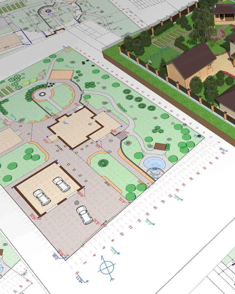
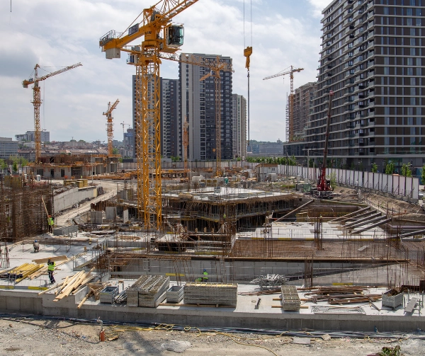
ProtoTech provides a comprehensive range of civil CAD drafting services, including site plans, grading plans, drainage plans, utility layouts, and detail drawings. We cater to various civil engineering projects, ensuring high-quality and accurate drafting that meets industry standards.

Q. How does ProtoTech ensure the accuracy of its CAD drafts?

We employ advanced software and experienced CAD professionals to create our drafts. Our team follows rigorous quality control processes, including regular reviews and validations against project specifications and standards, to ensure that every detail is accurate and reliable.

Q. Can ProtoTech handle large-scale civil engineering projects?

Absolutely! ProtoTech is equipped to manage both small and large-scale civil engineering projects. Our team has extensive experience in handling complex projects, ensuring that we can deliver efficient and precise CAD drafting services that meet your project requirements.

Q. What software does ProtoTech use for civil CAD drafting?

ProtoTech utilizes industry-standard software such as AutoCAD, Civil 3D, and Revit for civil CAD drafting. Our proficiency with these tools enables us to deliver high-quality drafts that facilitate effective collaboration and integration with other engineering disciplines.

Q. What is the turnaround time for CAD drafting projects?

Turnaround times vary based on the complexity and scale of the project. Typically, we aim to deliver initial drafts within a few days to a couple of weeks. We will discuss specific timelines during the project consultation to ensure that we meet your deadlines and project needs.

Empowering Clients, Achieving Goals

Browse Our Success Stories

Comprehensive Site Development Plan for a Large Multifamily Residential Complex

Enhancing Civil 3D with Custom Tag Insertion and Geo Coordinate Retrieval for Precise Modeling